skip to main
|
skip to sidebar
Showing posts with label
seafaring
.
Show all posts
Showing posts with label
seafaring
.
Show all posts
Thursday, November 15, 2012
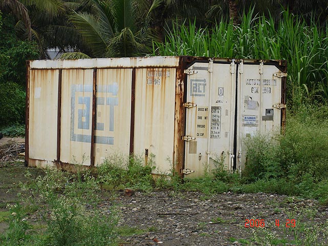
Shipping Containers
More images at
The Intermodal Container Web Page
. Some historical info is available at the
Ocean Liner Museum
.
Saturday, December 11, 2010
Navigational chart
Used by natives of the Marshall Islands, each chart is made and used by an individual intra-archipelago navigator. They serve as private mnemonic devices.
At the Met's Oceana wing.
Published with Blogger-droid v1.6.5
Older Posts
Home
Subscribe to:
Posts (Atom)
Labels
3D interface
abstract
advertisement
album art
alienation
anecdote
animals
animation
aquifier
Arab
architecture
art
Artist
Astoria
automobiles
background
bacteria
Baltimore
baseball
basketball
Bauhaus
biology
blue
bodega
book covers
branding
Brazil
Brooklyn
Bushwick
cardboard
Carroll Gardens
cartoon
cats
ceramics
Chelsea
Chinatown
chinese
chiropractor
church
Cincinnati
cities
coding
collage
color
comics
containers
corporate design
costume
country
creepy
cute
cycling
dance
dark
death
decorative
Denmark
Designer
diagram
digital art
Disney
Downtown Brooklyn
drawing
drugs
Dutch
dynamic identity
Egon Schiele
El Salvador
electronica
encyclopedia
ergonomics
exhibition
face
Face tags
fashion
figural
film
finances
Flash
Flatiron
folk
folk lore
Fort Greene
found
found sculpture
French
fruit
funny
furniture
games
gaming
Genius
geology
geometric
GIF
glass
glasses
glassware
good luck
graffiti
graphic design
green
Greenpoint
grid
hair
Han dynasty
hand tinting
hands
handsome
Harlem
hats
hip hop
history
home
house music
human figure
humor
iconography
illustration
industrial design
information design
installation
Intent
interactive
interiors
Internet
Italy
Japan
journaling
jugendstil
jungle
kids
kinetic scultpure
Korea
Korean
Latin America
Life
Life/Work balance
line
logos
Long Island City
Manhattan
mask
masks
men
Merchant
metal
metaphors
Mickey Mouse
microscopic photography
mobile
models
monocase
montage
music
music video
Native American
navigation
Neck Face tag
New Guinea
new look
New York
New York City
New Yorker
NoHo
Nolita
numeralology
nursery rhymes
Oceana
over the top
packaging
painting
paper
parallax
pattern
Performer
philosophy
photo-illustration
photography
Photoshop
plants
poetry
politics
posters
product design
products
programming
Prospect Heights
psychadelia
public works
Queens
reproduction
robots
roles
rug
Russia
scary
science
sculpture
seafaring
sexy
Shapes tag
shipping
signage
small business
so so cool
SoHo
soul
South America
speed of sound
Sport
steel
Steiner Steiner
street
street photography
stripes
style
Sweden
symbols
tabletop
tanuki
tattoo
technology
textile
textiles
the Abyss
the Met
the Neighborhood
theater
Thomas Edison
Tibet
tool
toys
transportation
tribal
type design
typography
undersea
Upper East Side
video
video games
Vienna Secession
violence
visionary art
warning
weaving
web design
weird
West Village
Wikipedia
Williamsburg
Williamsburg Bridge
wisdom
Wolverine
women
wood
words
Work
worlds
WTF
xenakis
yellow
Zooming User Interface
Blog Archive
▼
2012
(16)
▼
November
(14)
Hotline Miami
Cyanobacteria
Shipping Containers
Pragmata Pro
Henri Rousseau
Metropolis II
Toshiro Mifune
Robert Wilson
Hugo Kükelhaus
Magic Kingdom
Death/Traitors
Pid
BAKA!!
BALLPIT
►
January
(2)
►
2011
(7)
►
July
(1)
►
June
(1)
►
May
(1)
►
April
(1)
►
March
(3)
►
2010
(96)
►
December
(5)
►
November
(8)
►
October
(4)
►
September
(7)
►
July
(6)
►
June
(9)
►
May
(15)
►
April
(6)
►
March
(7)
►
February
(26)
►
January
(3)
►
2009
(42)
►
December
(2)
►
November
(6)
►
October
(1)
►
September
(4)
►
July
(10)
►
May
(16)
►
April
(3)
Reading
Brand New
Consumed